"In vielen verschiedenen Branchen, beispielsweise Speditionen, Transportunternehmen
und im Baugewerbe zählt das Flottenmanagement bereits zum Alltag.
Bleiben SIE nicht zurück!
Sie können ganz einfach Ihren Innendienst und den Außendienst (Vertriebsflotte oder
Lieferfahrzeuge) ohne lästiges Telefonieren verbinden.
Eine einfache und doch so effektive Lösung biete Ihnen die OrtungsLogistik UG mit
dem Fuhrpark-Management. Durch die bewusst einfach gehaltene Bedienung und leichte
Einbindung in die bestehende Infrastruktur möchten wir Ihnen die Arbeit angenehm
gestalten.
Sie entscheiden WER, WANN, WO und in WELCHEM Umfang das System nutzen darf. Eine
einmalige Einrichtungsgebühr macht Sie unabhängig von Arbeitsplatzlizenzen.
Die fest im Fahrzeug verbaute Blackbox sendet alle 15 Sekunden oder auch minütlich
GPS-Koordinaten und wir kümmern uns um die Darstellung.
Mit einem Mausklick können Sie die Daten anzeigen oder einfach nach Excel exportieren.
Viele kleine Helfer stehen Ihnen in der Anwendung zur Verfügung, wie beispielsweise
die Fahrzeugliste, die Spesenabrechnung, das Fahrtenbuch oder einfach die Gesamtansicht
aller Ihrer Kunden. Das macht Ihren Büroalltag leichter.
Machen Sie sich doch einfach selbst ein Bild und vereinbaren Sie einen Beratungstermin.
OrtungsLogistik UG
Klosterstr. 4
D-91301 Forchheim
Fon: +49 (9191) 71 67 80 -0
Fax: +49 (9191) 71 67 80"
- About Us (view on Google Sidewiki)
27.10.09
Tolle Prosa
Interessante Verbindung
Vodafone - OrtungslogistikUG
Herausgeber
OrtungsLogistik UG (haftungsbeschränkt)
Klosterstr. 4
D-91301 Forchheim
Geschäftsführer:
Frank Päsler
Fon: +49 (9191) 71 67 80 -0
Fax: +49 (9191) 71 67 80 -9
Amtsgericht Bamberg
HRB: 6343
USt-IdNr:
DE 264435388
5.8.06
Neue Funktiom
Saved locations on Google Maps8/04/2006 11:35:00 AMPosted by Thai Tran, Product ManagerOne of the most common requests we've received is for the ability to store a list of personal addresses on Google Maps -- and now you can. To get started, click on the "Saved Locations" link in the upper right corner of the site and sign in to your Google Account. If you're already signed in, this link will take you to your saved locations list -- Google Maps will automatically save every location you search for. You can also go to the Saved Locations list to disable auto-saving of locations or to add, modify, or delete previously-saved locations.
2.8.06
Mal sehen
Think you need to write scripts and use JavaScript if you want to write Atlas apps? Think again. Jesse Liberty shows you an easier, more effective, and more productive way--using drag-and-drop programming.
Tolle neue Mashups aus Maps Mania
Discover Hong Kong with these Google Maps mashups and viewing tools:
Wikimapia lets you explore Hong Kong - Wikimapia features hundreds of user described buildings, parks, skyscrapers, airports and numerous other places in and around Hong Kong. It's a great way to match Google Maps satellite imagery with community-driven descriptions. I regularly use Wikimapia to research my travel destinations and for Hong Kong specifically there are tons of locations to explore!
Hong Kong sights and hotels - Pongu's Travel Community is a Google Maps mashup of notable Hong Kong attractions and locations and nearby hotels to these sights. As you hover over a pin the location name is given with options to zoom to that location or link off to a page to read more detail and photos. It's a nice little mashup to browse around on if you are traveling to this area. [Via ProgrammableWeb.com]
Other Hong Kong Google Maps mashups and tools:
Sightseeing with Google Satellite Maps: Hong Kong
Tagzania: Hong Kong
Google Sightseeing: Hong Kong
Platial: Hong Kong
Maplandia: Hong Kong
Virtualisierungslösung Xen
Und warum? Ich vermute, weil es Konkurrent Novell zuerst geschafft hat, Xen in sein Enterprise-Linux zu integrieren.
Google Maps

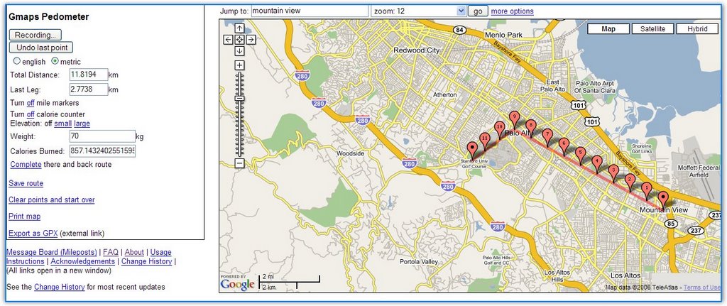
Gmap Pedometer is a site that uses Google Maps to let you record distances between two or more places. You can create routes for your running, see how many calories you're going to burn and save the route for further referencing. The author of the site explains: "As a runner training for a marathon for the first time, I found myself wishing I had an easy way to know the exact distance a certain course is, without having to drag a GPS or pedometer around on my runs." It's always a good idea to make some exercise at least once in a while, if not every day. And you can use the new iPod Nike shoes.
Related:
Google Maps with photos
Anthropomorphic Google Maps
31.7.06
T-Mobile ROM für MDA
"TMOBILE has posted the long awaited ROM (ver 2.26) for the MDA USA. It contains a Radio Fix addressing the searching, signal acquirring issue as well as A2DP. Remember, you need a Fully Charged MDA before you get started, and make sure your PC will not go into Hibernate during the install. Also, on a personal experience note, I had a 3-5 minute pause when I got to 85%. Just as I began to worry, it picked back up. You never want to disturb the process or disconnect the cable. Complete instructions are included in the ROM Upgrade."
Für Entwickler
Read/Write Web kicks off part two of Search 2.0 vs Traditional Search with this graphic…
And includes this tasty morsel…
“Krugle delivers the precise help and knowledge that programmers need to solve their immediate problems.”
Meanwhile in other news (I always wanted to write that on a blog), Krugle is mentioned in a ZDnet column — New Google service for developers — that’s been picked up and re-run on quite a few other sites. The piece speculates about some opensource related offering that Google is evidently hinting around about. Your guess is as good as ours at this point. Maybe better. Apparently, more is to be revealed on Thursday at OSCON.
28.7.06
Bamberg
Der Bamberger Medienforscher Jan Schmidt kündigt eine Nachbefragung zu seiner Studie “Wie ich blogge?!” (erste Welle: über 5000 Umfrageteilnehmer) an, deren Ergebnisse im September veröffentlicht werden sollen. Spannend zu lesen ist außerdem Schmidts konstruktive Auseinandersetzung mit dem Buch “Kopfjäger im Internet”, der Blog-Studie von Matthias Armborst. Schmidt setzt Armborsts Erkenntisse, die sich ja speziell mit [...]
Online Medien
Was zeichnet europäische Online-Medien aus? Pascal Deter ging dieser Frage im Rahmen seiner Diplomarbeit nach, untersuchte bereits bestehende Angebote und erarbeitete Anforderungen für künftige Projekte. Kann das Internet zur Entwicklung einer europäischen Öffentlichkeit beitragen? Die Voraussetzungen sind gegeben. Nötig ist es zweifellos. Vogelgrippe, steigende Ölpreise, Integration von Immigranten – immer mehr Themen können [...]
19.7.06
GEZ
DÜSSELDORF. Beispiel: Ein Freiberufler, der am heimischen Computer seine geschäftlichen Mails abruft, muss dafür im kommenden Jahr monatlich bis zu 17,03 Euro zahlen. Auch der Handwerksmeister, der im Betrieb ohne Radio und TV auskommt, aber eine Internet-Verbindung haben muss, um Umsatzsteuer- oder Sozialabgabenmeldungen online abzuschicken, wird für seinen Computer von der Gebühreneinzugszentrale der öffentlich-rechtlichen Rundfunkanstalten (GEZ) zur Kasse gebeten. Ob der Rechner für den Rundfunkempfang genutzt wird oder einem völlig anderen Zweck dient, spielt keine Rolle.
18.7.06
AJAX
Let's face it, cross site AJAX is a real pain. If you're going to provide your components as a service, sort of like Google maps, you're task is not impossible yet still challenging. If you want to mash up your...
13.7.06
12.7.06
Google Maps. We're making these new features available to API v2 users
Posted by Liz Xu, Software Engineer
Today we're enabling some new zoom features on Google Maps. We're making these features available to API v2 users as well, so please test them out and send us your feedback!
- Double-click to zoom. Instead of double-clicking to recenter the map, we now support left double-clicking to recenter and zoom in one level, and right double-clicking to zoom out one level. This can be enabled or disabled by calling enableDoubleClickZoom() or disableDoubleClickZoom() from a GMap2 instance. By default, double-click to zoom is disabled for API sites, since navigation in some API applications relies on the old behavior.
- Continuous zoom. For users of Firefox and Internet Explorer on Windows, we provide a smooth, continuous zoom animation when you zoom in one level. We turn off overlays during the zoom animation, so this may not be suitable for all API sites. To enable or disable continuous zoom, call enableContinuousZoom() or disableContinuousZoom() from a GMap2 instance. By default, continuous zoom is off.
For more details on zooming, please see the documentation. Don't forget to let us know what you think via the Maps API discussion forum.
Happy zooming!
11.7.06
Open GIS
WAYLAND, Mass. June 5, 2006 - The membership of the Open Geospatial Consortium, Inc. (OGC) has approved and released the OpenGIS(R) Geography Markup Language (GML) Simple Features Profile Specification. This standard defines a simple profile of GML version 3.1.1.The OGC's GML specification ...
What is Geoserver
GeoServer is an Open Source server that connects your information to the Geospatial Web.With GeoServer you can publish and edit data using open standards. Your information is made available in a large variety of formats as maps/images or actual geospatial data. GeoServer's transactional capabilities offer robust support for shared editing. GeoServer's focus is ease of use and support for standards, in order to serve as 'glue' for the geospatial web, connecting from legacy databases to many diverse clients.GeoServer supports WFS-T and WMS open protocols from the OGC to produce JPEG, PNG, SVG, KML/KMZ, GML, PDF, Shapefiles and more. More information on specific features of GeoServer can be found here, and some samples of GeoServer in action are in the gallery.Geoserver is built on Geotools, the same Java toolkit that udig uses. GeoServer is a truly open community, with a well documented and modular codebase, so don't hesitate to get involved.Read more about what GeoServer is here.
10.7.06
Mapping API
Description Mapping services Category Mapping Tags mapping Date Reviewed 2006-07-09 Version
API Home Page http://www.globexplorer.com/products/imagebuilder
-
From their site:
We offer instant metered Internet access to the world's largest aerial, satellite, and map image database, available in a range of customizable subscription packages. Our software development kit makes it simple to integrate our content into Web sites, and our flexible API's allow customers to incorporate a variety of complimentary information, such as property information, street maps, and parcel maps. We also sell extensions for mapping software and off-the-shelf CD image products. Additionally, our engineers can create and install custom applications to incorporate our content into virtually any business environment.